
Detection, monitoring, and warning in one system.
AWARE sensors detect rising water at your crossings and river corridors, the S.H.I.E.L.D. ⛊ software platform monitors every site continuously, and warning hardware activates automatically when thresholds are reached. All with one vendor.
Why AWARE
Detection, monitoring, and warning — all with one vendor.
AWARE builds the field sensors, the communications, the warning hardware, and the software platform that connects them. One integrated system, one point of accountability, one dashboard for every site.
Off-grid by design
Solar power with cellular or satellite communications. No trenching, no utility connection, no local network required at the site.
Built for the field
Field units are rated against wind, water, and extreme temperatures, with siren mounting hardware rated to 170 mph wind loads.
Detection triggers the warning
Threshold exceedance automatically activates sirens, voice instructions, beacons, road closure signals, SMS and email — no manual step in the chain.
Sensor-agnostic software platform
S.H.I.E.L.D. ⛊ hosts AWARE hardware alongside USGS data and Alert2-compatible systems from other manufacturers.

Products
Sensors, warning hardware, and the software platform that runs both
Deploy a single crossing or a county-wide network. Every component reports into one dashboard.
AWARE S.H.I.E.L.D. ⛊
Situational Hazard Intelligence & Emergency Live Dashboard — GIS mapping, live alert feed, configurable thresholds, and one-click compliance reports across every deployed site.
Explore S.H.I.E.L.D.AWARE Flood Detection
Flood node with three solar panels, a Water Level Pressure sensor on a 50 ft cable, and an optional 60° camera module for visual confirmation of site conditions.
View flood detectionLow-Water Crossing Warning System
Automated water level detection at roadway crossings with threshold-based alerting and flashing closure signals, replacing staff-driven manual closure runs.
See crossing warningOutdoor Flood Warning Siren System
High-powered omnidirectional siren arrays with pre-recorded voice instructions, flashing beacons, and solar power for fully off-grid public warning.
See siren systemsAWARE Node
Compact modular field node with solar power and rugged sensor inputs, supporting one-person installation. Deploy one or scale to hundreds across a network.
View the AWARE NodeAWARE Automatic Weather Station
Compact weather stations measuring temperature, wind, humidity and related conditions, deployable in the field without supporting infrastructure.
View weather stations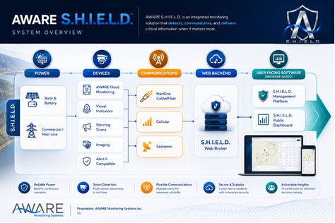
AWARE S.H.I.E.L.D. ⛊
Situational Hazard Intelligence & Emergency Live Dashboard
The software platform behind every AWARE system. It connects field power and devices through hardline, cellular, or satellite communications to a browser-based management platform and public dashboard — every sensor on one map, color-coded by status, with a running feed of threshold events by site, sensor, and timestamp. Nothing to install.
Live GIS map view
Site status across the whole network at a glance.
Custom alert rules
Thresholds, recipients and escalation paths per sensor.
Open API connectivity
RESTful integration with CAD, GIS and emergency management software.
One-click reports
Compliance-ready exports for any site or date range.
Team and access control
Built for multi-agency, multi-jurisdiction teams.
Hydrological forecasting
Trend analysis to anticipate rising conditions.
Proven in the Field
Real deployments. Documented outcomes.
Unified flood warning across a river corridor and watershed network
- Challenge
- A rapidly growing flood-prone county needed unified warning across a hazardous river and multiple watershed corridors, while activating sirens and crossing closures during fast-changing events. Previous methods lacked real-time visibility.
- Solution
- S.H.I.E.L.D. ⛊ integrated 30+ flood inundation sensors, 10+ roadway warning systems, cameras, and 10 automated sirens into one operational dashboard, with thresholds configured by location.
- Result
- Street-level visibility into flood conditions and automated public warning activation during a 2025 flash flood and river rise event that resulted in no reported injuries or deaths.
Replacing manual closures at 12 low-water crossings
- Challenge
- A county emergency management office needed automated monitoring at 12 low-water crossings to replace costly, hazardous staff-driven manual closures and shorten closure decisions during major weather events.
- Solution
- AWARE communications nodes were deployed at all 12 crossings with Water Level Pressure sensors and site-specific flood-stage thresholds, streaming to dispatch and public works via S.H.I.E.L.D. ⛊.
- Result
- Closure decisions within minutes of threshold conditions. Manual closure requirements were significantly reduced and personnel exposure lowered.
Texas Senate Bill 3
SB 3 raised the bar for outdoor flood warning in Texas.
Post-2025 legislative action raised expectations for outdoor flood warning infrastructure across Texas municipalities and counties. S.H.I.E.L.D. ⛊ is fully SB 3 compliant for daily, weekly, and monthly siren testing, with automated documentation of every test.
AWARE provides deployment-ready architectures and complete technical documentation, so your agency moves from approved plan to operational deployment without redesigning the system.
Use Cases
Built for the agencies that answer for the outcome
State and Local Government
Continuous water level and stormwater tracking, so public works and county leadership can position resources ahead of an event rather than after it.
Government solutionsEmergency Management
Street-level situational awareness during active weather events, with automated public warning and a documented event record for after-action review.
Emergency managementAgriculture
Soil moisture, water level, and weather data across row crops, orchards, vineyards and pastures, without trenching, wiring, or bulky data loggers.
Agriculture solutionsEnvironmental Research
Autonomous, solar-powered monitoring that gathers and transmits data continuously from remote sites without repeat field visits.
Research solutionsDam, Spillway and Levee Safety
Tailwater and spillway crossing monitoring, with early indication of rising conditions between scheduled inspections.
Dam and levee monitoringDepartment of Defense
Environmental monitoring for installations and training grounds, including remote sites beyond cellular coverage.
Talk to our teamGetting Started
Three questions every agency asks
Will it work with what we already have?
S.H.I.E.L.D. ⛊ is sensor-agnostic. It hosts AWARE hardware alongside water level transducers, weather stations, and other environmental sensors you already operate, plus USGS data and Alert2-compatible systems from other manufacturers.
A RESTful API connects it to your existing CAD systems, GIS platforms, and emergency management software, so alerts arrive where your team already works.
Can we start smaller than a full buildout?
Yes. Phased deployment lets a community begin with its highest-priority crossings and corridors, then extend coverage over time on the same platform, with no rework of what is already installed.
Agencies evaluating a first deployment can apply for a pilot program. Our team offers no-obligation planning support, including coverage planning and site selection.
How do we reduce community risk and exposure?
Monitoring farther upstream creates awareness earlier, which gives emergency managers more time to act while conditions are still developing. Proactive monitoring replaces waiting for a call to come in.
Automated public notification helps keep residents informed as conditions change, rather than after the fact. These are tools designed to help reduce the risk of loss of life and to help agencies act early instead of explaining a late notification afterward.
How We Work
From first site walk to a network your team runs
A structured engagement model, so responsibilities and milestones are clear at every stage.
Discover
Confirm monitoring objectives, environmental constraints, stakeholders, and the measurable criteria that define success.
Design
Develop system architecture, coverage planning and site selection, communications strategy, alerting concepts, and deployment sequencing.
Deploy
Support installation, then commission and validate: signal strength verification, telemetry testing, alert trigger validation, and operator training.
Sustain
Health monitoring and preventative maintenance, troubleshooting support, spares and lifecycle planning, and ongoing optimization.
Real Deployments
What this looks like in the field
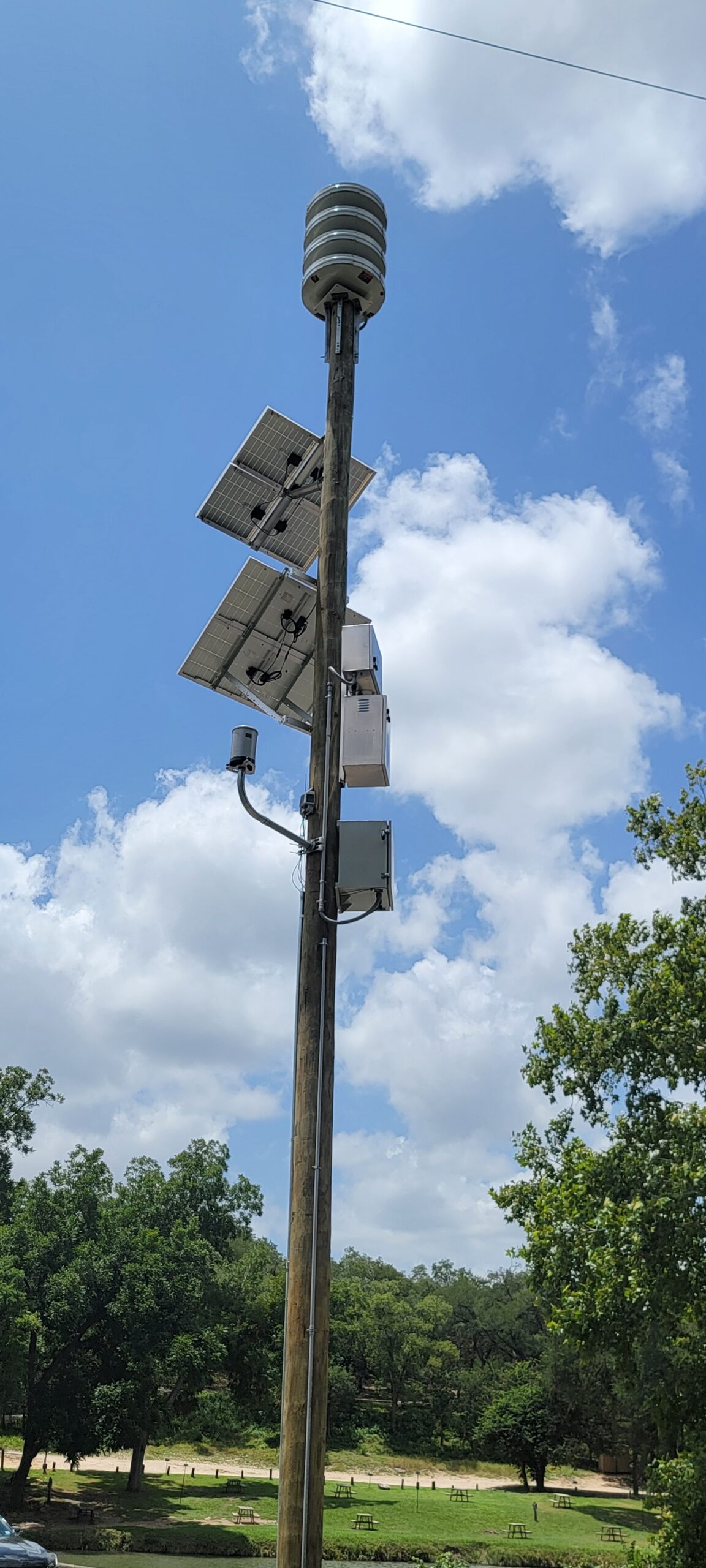
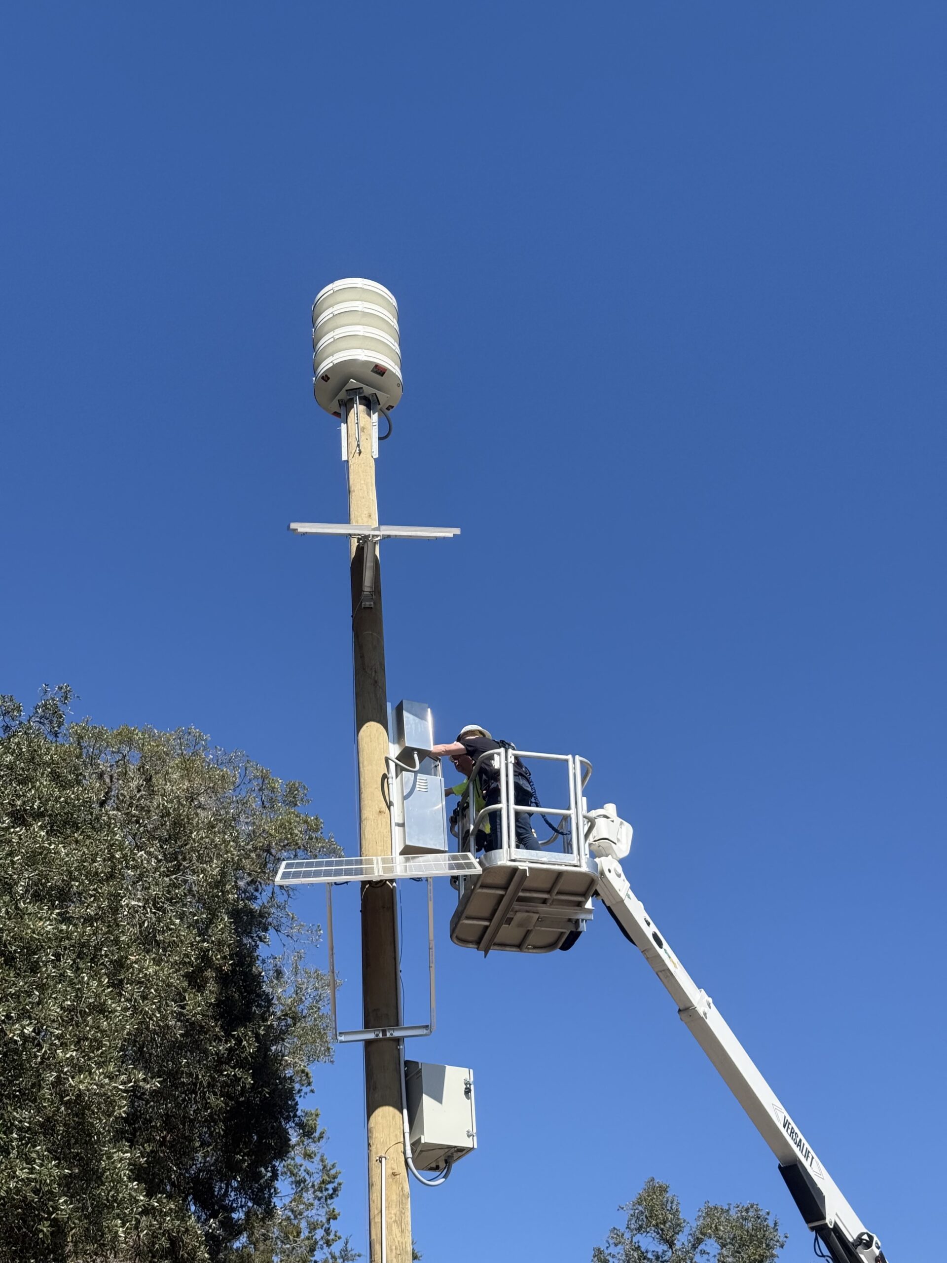
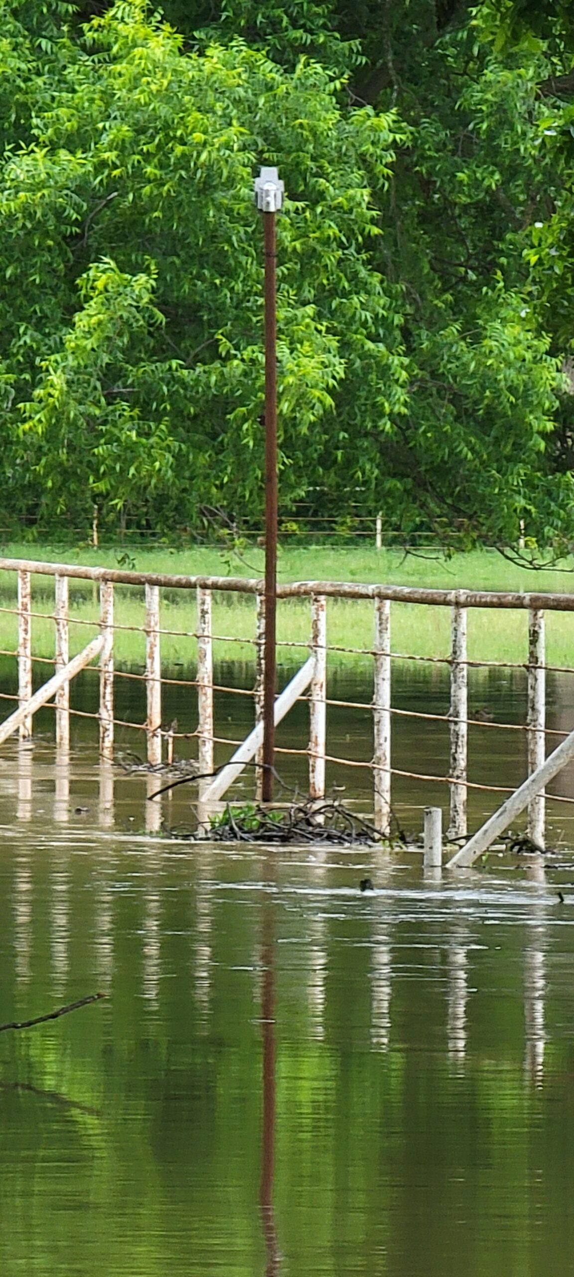
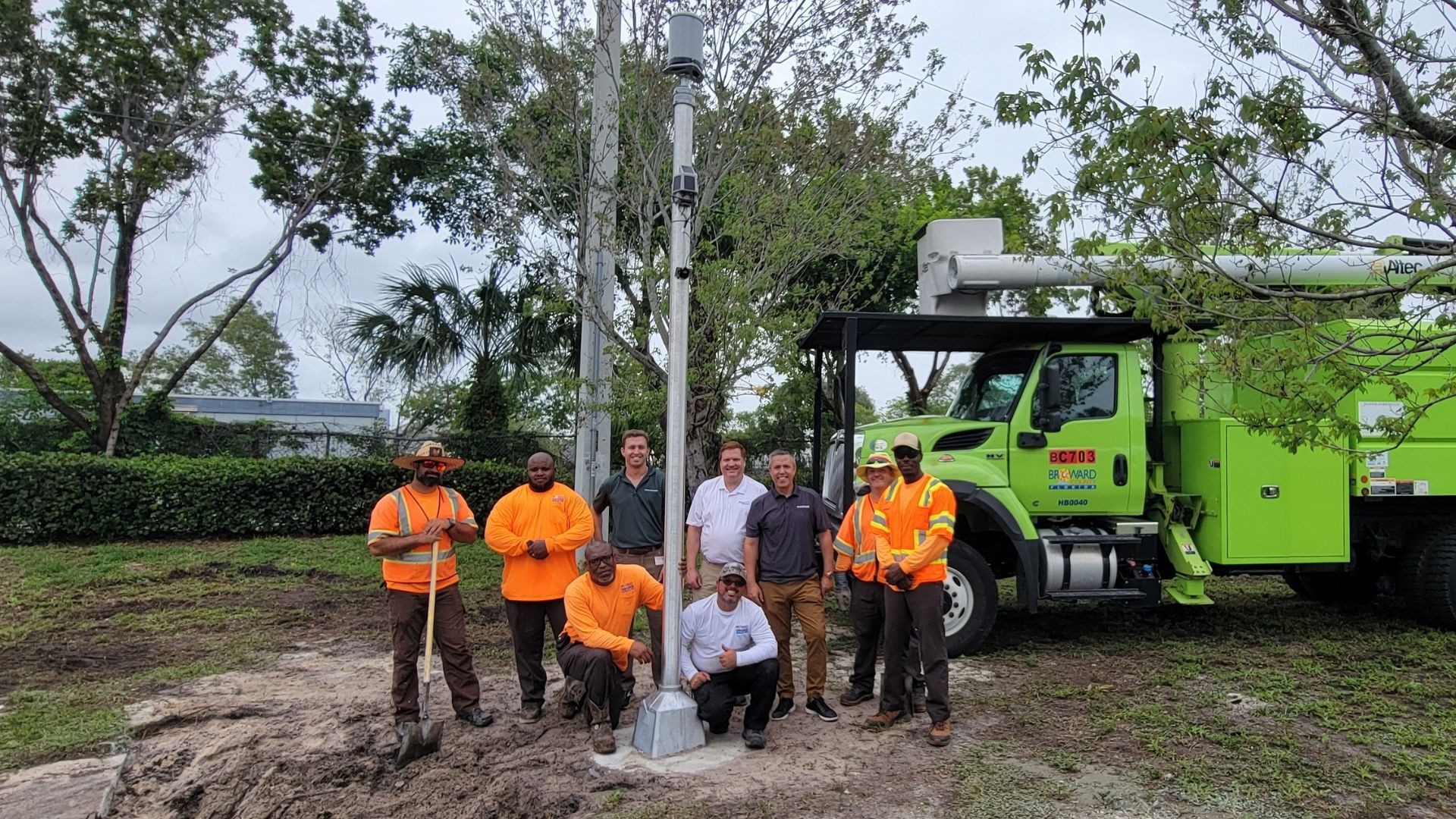
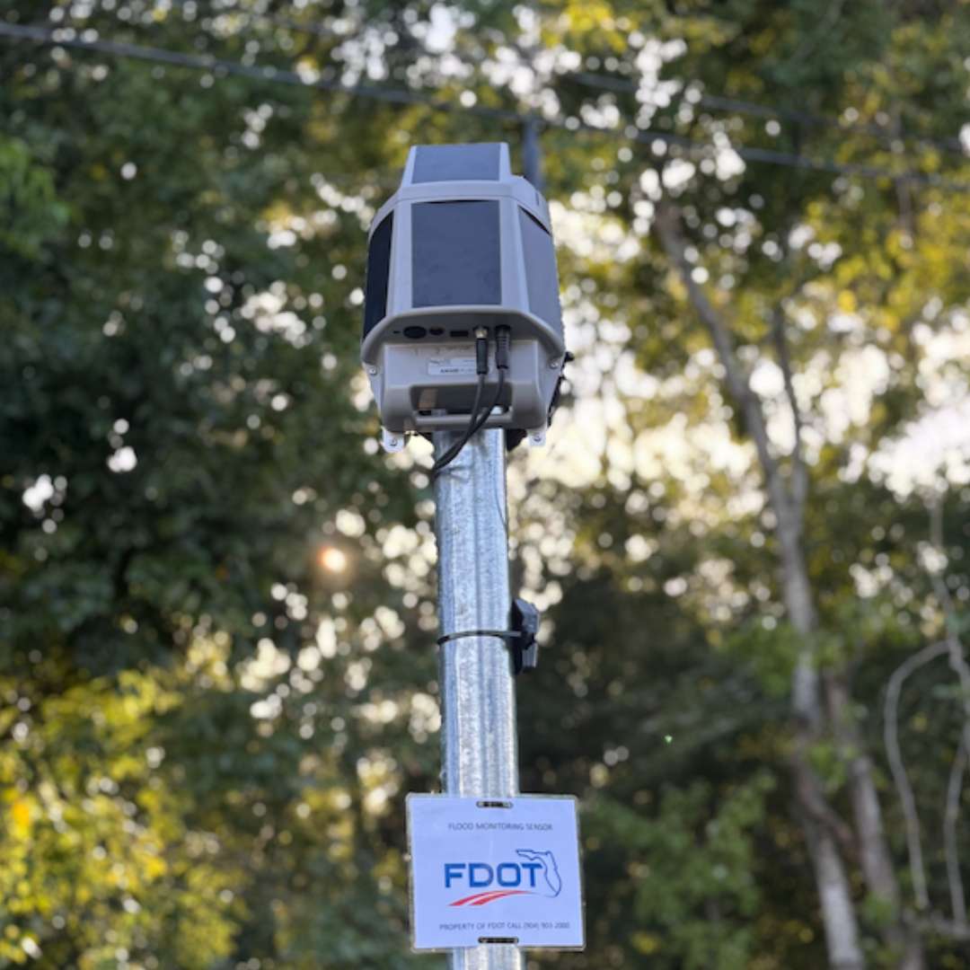
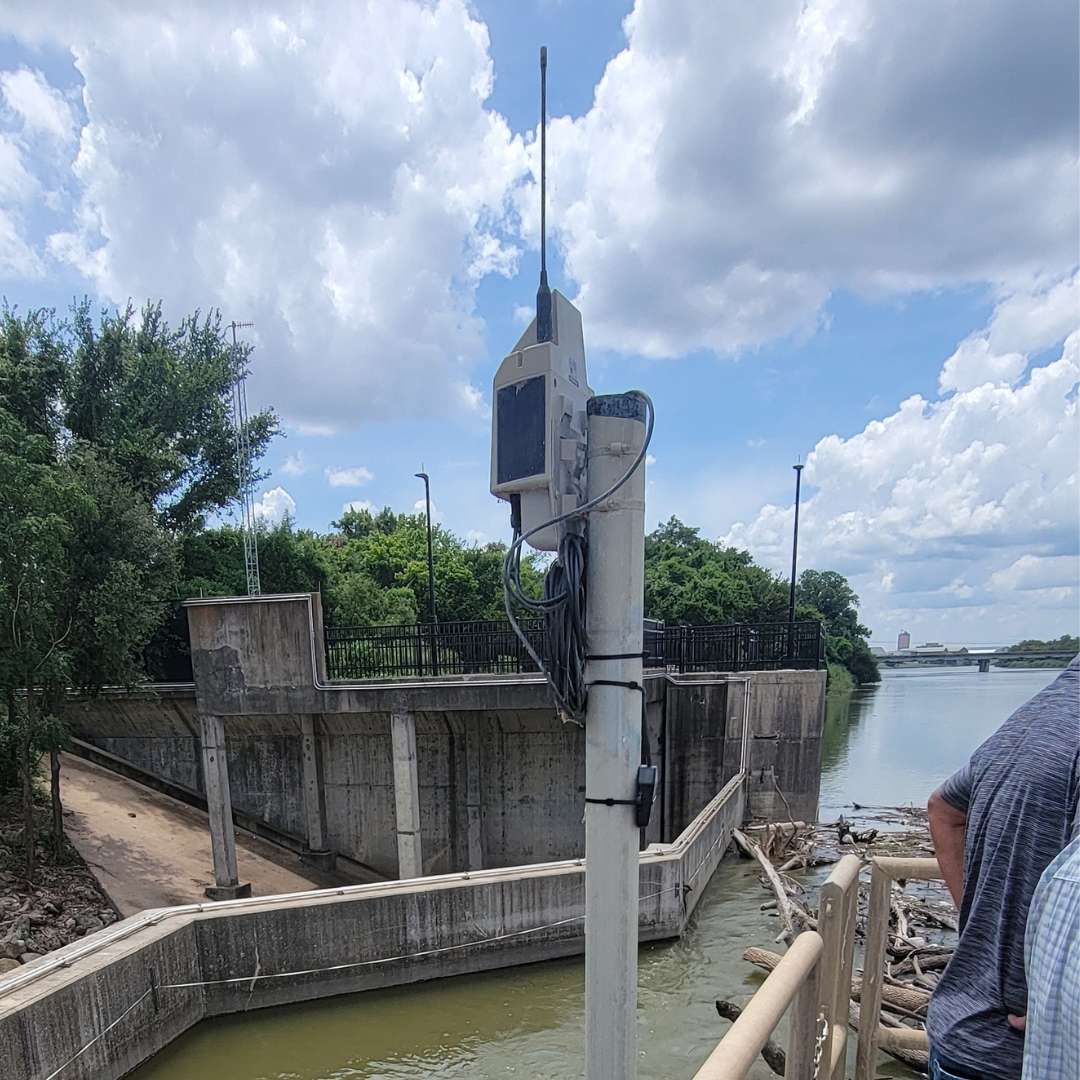
Installed and operating systems from active AWARE deployments.

FAQ
Frequently asked questions
What does S.H.I.E.L.D. stand for?
Situational Hazard Intelligence & Emergency Live Dashboard. It is the AWARE software platform for real-time monitoring, alert configuration, siren activation, and reporting. Explore S.H.I.E.L.D.
Does S.H.I.E.L.D. work with sensors we already own?
Yes. The platform is sensor-agnostic and is designed to support and host a variety of environmental sensors, including water level transducers, weather stations, air quality monitors, and industrial IoT devices. It also works with USGS data and Alert2-compatible systems from other manufacturers, and provides a RESTful API for integration with existing CAD systems, GIS platforms, and emergency management software.
Is the system SB 3 compliant for siren testing in Texas?
S.H.I.E.L.D. is fully SB 3 compliant for daily, weekly, and monthly testing of sirens, with historical archiving and reporting tools for compliance documentation and after-action review. See Texas-compliant outdoor flood warning systems.
How quickly can AWARE systems be deployed?
AWARE field nodes are solar-powered and connect over cellular or satellite, so installation requires no trenching, grid power, or local network. Systems can be deployed in high-priority areas within weeks.
What happens to the equipment during a hurricane or major storm?
AWARE nodes have proven durability in hurricane-force storms and six-foot floodwaters, and are built to withstand wind, water, and extreme temperatures. Siren solar mounting hardware is rated to wind loads up to 170 mph.
Can the system trigger sirens and road closures automatically?
Yes. When water levels exceed configured thresholds, the system automatically triggers road closure signals and siren activations, broadcasts pre-recorded voice instructions, activates flashing beacons, and sends SMS and email notifications, including statewide DOT notification when sirens are activated. Thresholds are configurable per site and sensor, with multi-tier support for advisory, warning, and closure levels.
What does AWARE monitor besides flooding?
AWARE deploys Automatic Weather Stations for temperature, wind, humidity and related conditions, and supports soil moisture and temperature monitoring for agriculture and land management.
Do you support installation and long-term maintenance?
AWARE supports the full lifecycle: coverage planning and site selection, communications architecture, deployment and commissioning, operator training, health monitoring, troubleshooting, spares strategy, and continuous optimization.
Still have questions? Talk to an AWARE specialist.
Contact
Discuss your project.
Tell us what you need to monitor, where the system must operate, and who needs to be alerted. Our engineering team works directly with DOTs, county agencies, and emergency management offices to design systems for specific crossings and operational requirements.
Headquarters
5950 Fairview Road, Suite 610
Charlotte, NC 28210
Regional Office
1364 Industrial St., Suite B
New Braunfels, TX 78130
Send us a message
Prefer to speak with someone directly? Call 855-292-7367 or email sales@awaremsi.com.
Know the water is rising before it reaches the road.
Tell us what you need to monitor, where the system must operate, and who needs to be alerted. We will define a clear path from concept to operational system.